
Late Professor Tom Meixner’s Passion for Cienega Watershed Lives on in New Virtual Tour
A team of UArizona researchers including Tom Meixner, Larry Fisher and Adriana Zuniga-Teran worked with local and international partners to create a free virtual tour of the Cienega Watershed southeast of Tucson.
Rich in natural resources, steeped in history and mired in controversy, the Cienega Watershed has been the subject of a nearly decade-long, innovative research project launched by UArizona researchers Larry Fisher, Tom Meixner and Adriana Zuniga-Teran. The project, which has inspired multiple spin-off programs in similar areas, aims to provide an annual glimpse at the overall health of the entire watershed ecosystem.
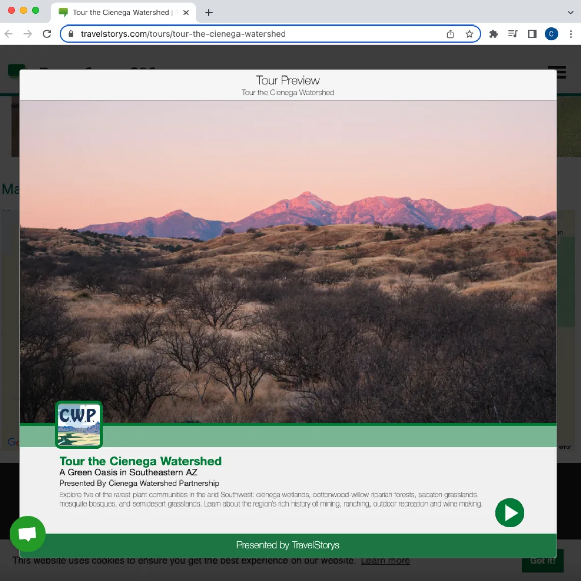
Today, with support from several local, national and international agencies and institutions, an informal outreach program first developed and led by Fisher, Meixner, and Zuniga-Teran has taken the form of a GPS-triggered, two-hour virtual driving tour available for free on the TravelStorys app.
The Land
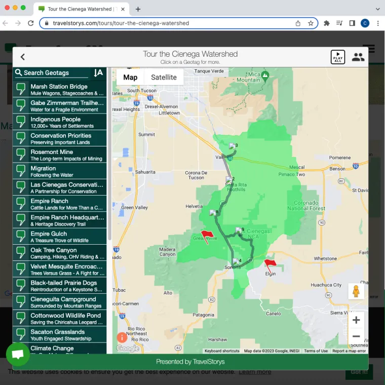
This map of the new Cienega Watershed Virtual Tour shows the area of the Watershed and the 2-hour driving tour route.
Just southeast of Tucson, the Cienega Watershed is a highly contested piece of land in an area bounded by the Whetstone, Santa Rita and Rincon Mountains on the east, west and north, and by the Canelo Hills on the south.
The area spans 207,659 acres and boasts a unique range of habitats including oak and ponderosa pine forests, cienegas (marshlands), cottonwood-willow riparian forests, sacaton grasslands, mesquite bosques, and semi-desert grasslands.
This diversity of habitat also makes the region a biodiversity hotspot. The watershed supports a variety of rare and endangered species, including an orchid known as Coleman’s coralroot and animals like the emblematic Sonoran pronghorn; elusive Mexican garter snakes and yellow-billed cuckoos; along with Chiricahua leopard frogs and Gila chub and Gila topminnow fish. The occasional ocelot and jaguar have also been seen in the area.
All of the precipitation that falls on the Cienega Watershed drains and percolates into an aquifer that feeds Cienega Creek, one of the few remaining perennial streams in the state. Cienega Creek also flows into Pantano Wash and the Rillito River, making it an important source of water for the City of Tucson.
In 2005, the area became tangled in a decades-long battle between conservationists and the mining industry when a Canadian company called Augusta Resources purchased land adjacent to the Coronado National Forest on the northeastern edge of the Santa Rita Mountain range with the intention to build the third largest open-pit copper mine in the United States.
A plan of operation for the so-called “Copper World Complex” – known locally as the Rosemont Mine project – was filed in 2007. Augusta Resources later merged with another Canadian mining company, Hudbay Minerals, which continued to buy up land in the area, eventually acquiring approximately 4500 acres to support their proposed mining operations.
Due to a series of prolonged legal battles, the permits for the project remain on hold indefinitely, meaning that parties on both sides of the debate have yet to secure an outright victory.
The ‘State of the Watershed’
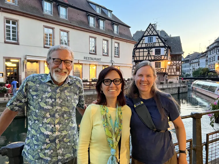
From left to right, Larry Fisher, Adriana Zuniga-Teran, and Larry's wife, Founder and Director of Southwest Decision Resources Tahnee Robertson pose for a photo by a canal in Strasborg, France in July 2023.
Adriana Zuniga-Teran
In response to the pending development of the Rosemont Mine, a team of UArizona researchers including Larry Fisher, research professor in the School of Natural Resources & the Environment, and the late Tom Meixner, the former professor and department head at the School of Hydrology and Atmospheric Sciences who was killed in a shooting on the UArizona campus in the fall of 2022, decided to start keeping an eye on the health of the Cienega Watershed.
Beginning in 2014, researchers worked with the nonprofit Cienega Watershed Partnership to monitor and track dozens of indicators in the area such as aquifer depth, water quality, precipitation, biodiversity and vegetative cover in an effort to paint an annual picture of what they called the “State of the Watershed” (SOTW).
In early 2015, Meixner and Fisher reached out to Adriana Zuniga-Teran, then a recent graduate of the UArizona Arid Lands Resource Sciences doctoral program, to help with aggregating and analyzing the data for their first SOTW report. Zuniga-Teran, who is now an assistant professor at the Udall Center for Studies in Public Policy and the UArizona School of Geography, Development & Environment, still works in that role for the SOTW project. “We were tracking everything around the mine,” explains Zuniga-Teran. “The point of the assessment (was) to have long term data so, in case something happens with the opening of the mine, we have real evidence of that (impact),” she says.
Most environmental research projects look only at one data point or a limited set of data points at a time – the quality or volume of water in a creek or aquifer, for instance, or the abundance of a certain species of animal or plant – so it was a novel idea to try and characterize and assess the overall health of the ecosystem at once. But the effort paid off in more ways than one.
Not only is the model for the SOTW project now being duplicated in areas like the Sonoita Creek, Lower San Pedro and Altar Valley Watersheds in Arizona but, in 2018, the Cienega Watershed project attracted the attention of an international research institute known as the French National Center for Scientific Research (CNRS).
“Adriana, Tom and I were working on this State of the Watershed,” recalls Fisher, “and, at one of our annual meetings, I met a French scientist who said, ‘You know, what you're doing is fabulous… Would you be willing to accept a grant from us?’”
Thrilled at the prospect of being offered a three-year grant to sustain research which to that point had been inconsistently funded (and without having to first apply for the grant, to boot – a situation almost unheard of in academic research), Fisher, Mexiner and Zuniga-Teran readily accepted the assistance.
The only stipulation for accepting the funds was that members of the SOTW research team would have to travel to France for an annual CNRS gathering to present on recent findings and developments in the project. It was a requirement that didn’t exactly deter the research team.
Inspiration Strikes
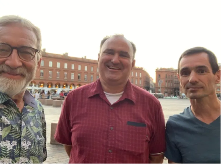
From left to right, Larry Fisher, Tom Meixner and CNRS lead François-Michel Le Tourneau pose in Toulouse, France in September 2021.
Larry Fisher
According to Fisher, public outreach was seen as a critical component of the SOTW project from the beginning. With that in mind, he and Meixner worked with the Cienega Watershed Partnership to organize regular tours of the area that allowed members of the public to learn about the Cienega Watershed directly from the scientists doing the research.
“Every few months, we’d do a watershed tour on a Saturday and we'd get six or eight specialists in water, wildlife ecology, mining, climate, archaeology, and other topics,” Fisher explains, “We'd get them out… and we'd drive up with a collection of people who had signed up for the tour. Sometimes there'd be five people, sometimes 25.”
The extra work acting as tour guides was completely voluntary and the researchers knew that the model was inefficient. When the COVID pandemic shut down in-person gatherings in 2020, those regular watershed tours ground to a halt, as well.
It was a year later during one of their trips to France for their annual presentation at the CNRS summit that Fisher says inspiration struck. While in Toulouse in 2021, Fisher says he and Meixner learned about a number of virtual tours of the city available for smart devices that would trigger educational audio based on the listeners’ proximity to a certain landmark.
“So, Tom and I said, ‘Wow, this is fabulous. This would be a very efficient way to do our watershed tours,’” Fisher says. Later during that same visit, CNRS human geographer François-Michel Le Tourneau asked Meixner and Fisher about their plans for an outreach program related to their SOTW research. The scientists pitched the virtual tour concept and the momentum for what would become the Cienega Watershed Virtual Tour started to build.
The Virtual Tour
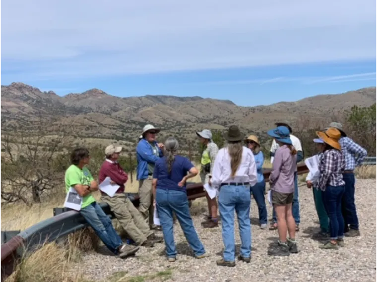
Tom Meixner (blue shirt and wide-brimmed canvas hat) speaks to a small group at the Rosemont turnout during an in-person tour of the Cienega Watershed.
Back in the states, the SOTW team began putting the wheels in motion for this new-and-improved method of outreach. “Everybody was really excited about the idea,” says Fisher, “(so) we started talking to other partners.”
They already had a greenlight from CNRS, so Fisher, Meixner, Zuniga-Teran and team began coordinating with other organizations and agencies in the region. Nonprofits like the Cienega Watershed Partnership, the Empire Ranch Foundation, the Santa Cruz Valley Heritage Alliance, and the Arizona Land and Water Trust offered their support. So did Pima County’s Division of Natural Resources, Parks and Recreation and the Bureau of Land Management, which operates the 45,000-acre Las Cienegas National Conservation Area in the watershed. Zuniga-Teran enlisted the help of the Udall Center for Studies in Public Policy. They even secured support from the Vera Earl Ranch, a local private cattle ranching operation, to help make the proposed tour a reality.
Over the course of the next year, the team identified roughly a dozen experts in a variety of subjects to choose the important sites and write about them in a way that was amenable to the virtual tour format – a style of writing that was altogether different than that associated with the traditional academic or scientific reports the project stakeholders were used to. Fisher managed much of the editing process and offered his voice for narration on several segments.
Other stakeholders like former Cienega Creek Natural Preserve Manager Juila Fonseca, rancher Ian Tomlinson, Empire Ranch Foundation members Allison Bunting and Faith Boyce, and Pima County Natural Resource Manager Karen Simms contributed their time, talents and insights to the project, as well. “You need lots of different expertise and many different voices to tell that story,” explains Fisher, adding that “...We know that the power of the partnership makes these things work.”
Today, the finished tour consists of 21 informational segments that trigger via GPS at various points of interest along the two-hour tour route. For those viewing online or in the passenger seat, the tour is also loaded with dozens of photos of plants, animals and landmarks in the watershed.
The topics covered vary widely and include insights on the human history of the area, information about the impacts of climate change in the region, spotlights on threatened and keystone species, glimpses at the businesses of winemaking and ranching, and the proposed location of the Rosemont Mine.
The tour is dedicated to Professor Tom Meixner, who tragically did not survive to see it launched.
Zuniga-Teran is also currently finalizing the translation of all portions of the tour into Spanish and recording the narration for the Spanish-language version of the virtual experience.
Potential impacts of this new digital resource abound, says Zuniga-Teran, from serving as a curiosity for locals and tourists, to providing an additional learning experience for students venturing into the borderlands, whether by themselves or as part of a classroom field trip.
A Fusion of Passion and Profession
Fisher says that the Cienega Watershed Virtual Tour was and is as much a passion project for himself and Meixner as a professional one. “Tom and I were great friends because we shared this kind of common commitment that our science was useless unless it was tied to something real,” he says, “to people and to policies and programs.”
That, says Fisher, is the real value of the tour: helping real people experiencing the Cienega Watershed in person to better connect with their surroundings and, hopefully, become better stewards of the area.
“We're trying to promote it to as wide an audience as possible,” says Fisher, “but particularly to those people who are new to the public lands, who are new to being outdoors, who don't know the watershed, don't know its history, don't know its conservation values, don't know the threats and how they can be a positive presence.”
For individuals who may not have the necessary access or means to experience the tour in person, it can also be viewed in its entirety on the TravelStorys website from any location with an internet connection.
For those interested in learning more about the virtual tour or the Cienega Watershed itself, Fisher had some advice: “I would say drive it. Experience it,” he says.
It’s a trip that should appeal to amateur and professional historians, naturalists, and ecologists of all ages around the world and, certainly, those here in southern Arizona.